
Reading Topography Maps - Intro + Activity page
Topography Maps | STEM & Geography Activity for Kids
Grades: 3rd – 6th Format: Printable PDF Pages: 1 (black and white, interactive worksheet)
This is a fun, real-world geography skill that helps kids think like explorers while practicing how to read maps! ✨
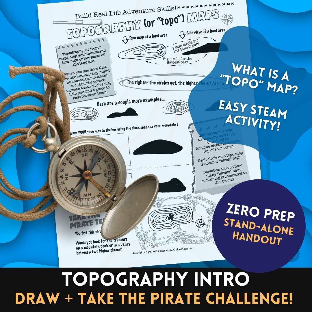
Bring geography to life with this engaging hands-on activity worksheet that introduces students to topographic (“topo”) maps and how they represent land elevations! This activity helps kids understand how to read contour lines, visualize elevation, and even test their knowledge with a fun pirate treasure map challenge.
✨ What’s Included:
- Clear, kid-friendly explanation of topographic maps
- Visual examples of how circles represent land elevation
- Practice activity: Draw your own topo map based on mountain shapes
- Fun “Pirate Test” challenge map for critical thinking and problem-solving
- Easy-to-understand vocabulary: elevation, contour lines, high/low land
✨ Skills Covered:
- Reading and interpreting maps
- Understanding elevation and landforms
- Visual-spatial reasoning
- Problem-solving & critical thinking
✨ Perfect For:
- Geography & Earth Science lessons
- STEM/STEAM activities
- Outdoor education or adventure-themed units
- Early finishers, enrichment, or sub plans
Curriculum Alignment:
NGSS:
• 4-ESS2-2: Analyze and interpret data from maps to describe landforms
• MS-ESS2-2: Maps used to explain Earth’s surface features
C3 Social Studies Standards:
• D2.Geo.2.3-5: Use maps to explain spatial patterns of environmental characteristics
• D2.Geo.3.3-5: Use maps to explain relationships between locations and places